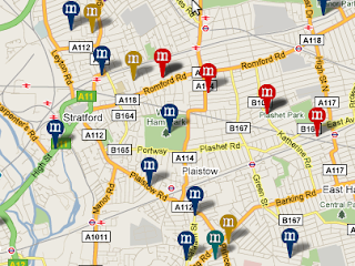
I'm a bit hesitant in recommending this website that I've just discovered, given its gruesome content. It's the 'Murder Map', a clickable overlay to Google Maps that shows where murders have taken place in London, using information gleaned from court reports. They've even colour-coded the pins according to how someone met their end - dark blue for being stabbed, or red for being shot.
If you do have a morbid sense of curiosity, you can zoom right down to your local area and click on the pins for some more details about the case. In a way its a shame that you can't look at the locations of the most notorious London murders, which might give the cases that are recorded a bit more historical context - for instance you won't find the site (a Hampstead pub) where Ruth Ellis shot her philandering boyfriend, and subsequently became the last woman to be hanged in England. The maps only seems to show information from the last couple of years - I imagine because that data is in a easily accessible machine-readable format.
Anyway, there you are - make of the site what you will...

0 comments:
Post a Comment